
Detecting changes – spring secondment at IQS in Barcelona
17 Jun 2025
0
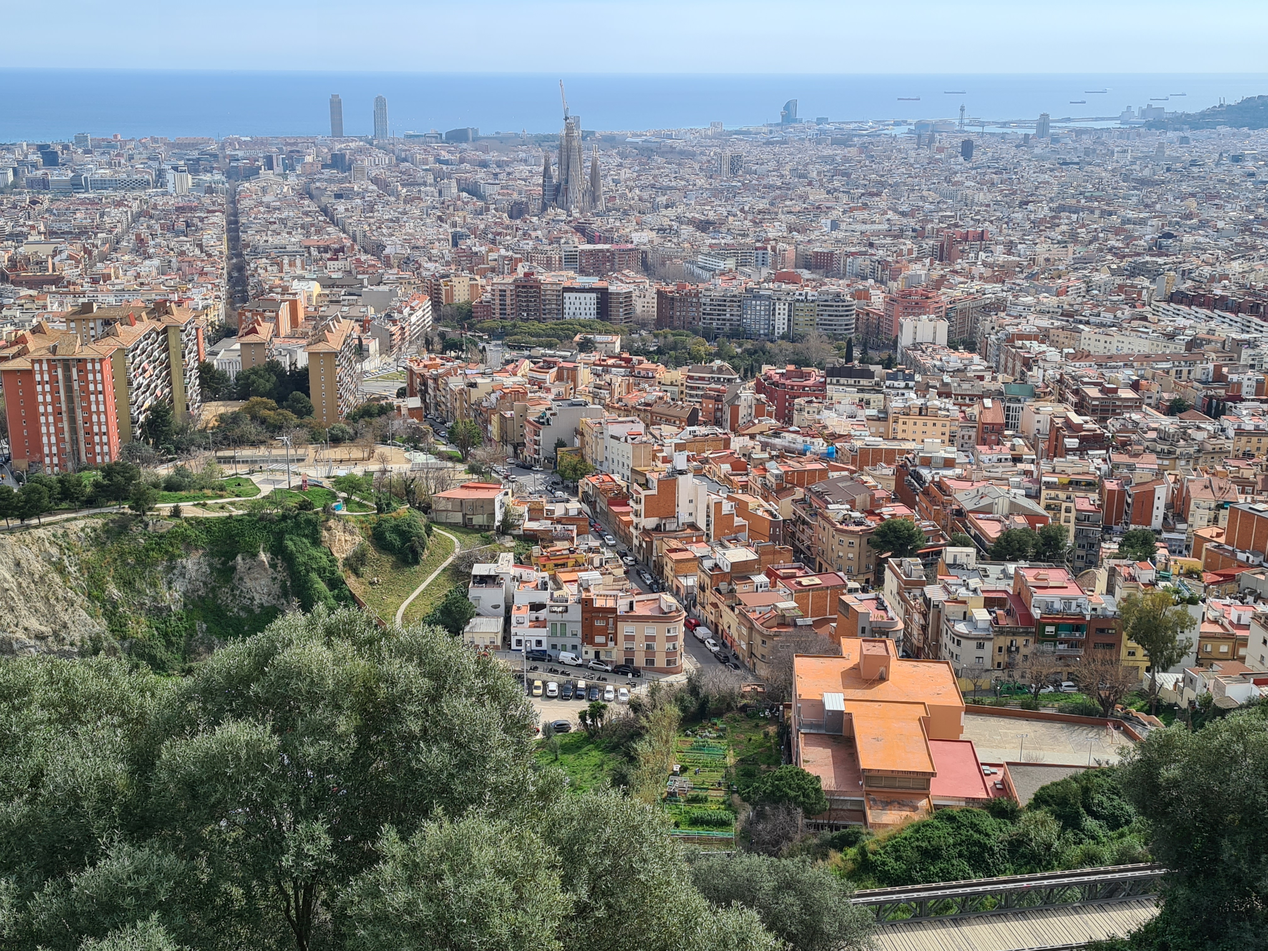
As a wise man once said: "The only constant in life is change". The wise man to whom this sentence was attributed was a Greek scholar called Heraclitus. Heraclitus was a philosopher who lived in the 6th century BC. Like all ancient Greeks, he was aware of, for example, the changing of the seasons, the ageing of living beings and the scientific progress of civilisations. Could he have guessed that mankind would one day build structures more than 800 metres high? That a journey from Athens to Sparta would take less than 3 hours? That mankind would set foot on the moon? That in 2010 a car park in Sarria, Barcelona (which didn't even exist at the time) would be demolished and in December 2012 the new IQS School of Management building would be inaugurated on the same site?
Probably not.
But all the things mentioned have happened and some are still happening. Change happens.
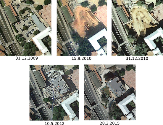
The construction of the new IQS School of Management building was probably well documented with photos from digital cameras taken from the ground and written documents. What most people involved in the construction process didn't realise is that it was also documented from space. With satellite images. The 21st century marked the beginning of civilian, very high-resolution imaging from space, which was done by large commercial satellites capable of capturing images with a spatial resolution of less than one metre. This means that the size of the pixels is very small and many details can be seen in the image. Initially, these images were only taken by a few satellites, but it soon became clear that this type of images could have a high utilisation rate in many applications. Shortly before 2010 and in the following years, more VHR satellites were launched, providing more and more images of all parts of the world. The area around IQS was no exception. Since 2007, the area has seen a sharp increase in images showing the changes in land cover/land use in Sarria. The high density of images shows the construction of the new IQS building, which took place between 2010 and 2013. As can be seen in the image below, the car park was still there at the end of 2009, was demolished in 2010 and the same area was then used for the new building, which appears to have been almost completed in May 2012. The images shown here are from Google Earth, which is free for anyone to access.
The building is now home to many professors and students, but also to every researcher who visits the IQS as part of the PoPMeD-SuSDeV project. Including myself. As an expert in satellite remote sensing (Earth observation) and geographic information systems (GIS), I was more interested in the “spatial” side of the projects carried out at IQS and also very interested in the detection of land cover/land use change. Like the new IQS building.
Change detection is one of the most important tasks in remote sensing. Its aim is to detect changes in the observed areas by comparing precisely georeferenced images taken at different points in time. This technique can be used in various areas, from land use to structural changes and disaster assessment. With the increasing number of satellites and the rapid development of their optical and sensory components, change detection is able to provide precise evidence of change with high spatial and temporal detail. This basically means that nowadays we can get a nice optical image from space almost every day, clouds permitting. These high-quality images can provide very useful results, which are usually obtained using machine learning algorithms. In recent years, these algorithms have turned to deep learning technology, which can improve the results enormously if enough learning data is used.
So can we use remote sensing images from satellites to detect houses, individual trees or even cars? Yes. Can we detect specific changes to the objects mentioned? Yes. Does this mean that we can monitor the construction of a building or the condition of a tree? Yes, of course. It is also possible to monitor them on a larger scale and detect the expansion of cities or forests. The information gained from classification and change detection can easily be integrated into other areas of research that seemingly have nothing to do with remote sensing. For example, remote sensing can be used for issues related to sustainability, the environment, socio-economic aspects as well as poverty, inequality or even aporophobia. The same areas that are being researched by the researchers working together in the Sustainability, Economics and Ethics (SEE) group at the IQS and are also part of the PoPMeD-SuSDeV project.
To come back to Heraclitus - he was absolutely right. Change is a constant and is happening all the time. And can be observed. The only difference to antiquity is that today we have better opportunities to observe change. Better equipment, better methods and better knowledge. Today we can understand change better. Because understanding change can also be good for international cooperation.
Written by Aleš Marsetič (ZRC SAZU)